
Land Mapping
What are some benefits to using a drone?
Reducing field time and survey costs
Providing accurate and exhaustive data
Mapping otherwise inaccessible areas
What are drones used for in surveying?
Land management and development
Precise measurements
Slope monitoring
Urban planning
New development surveys
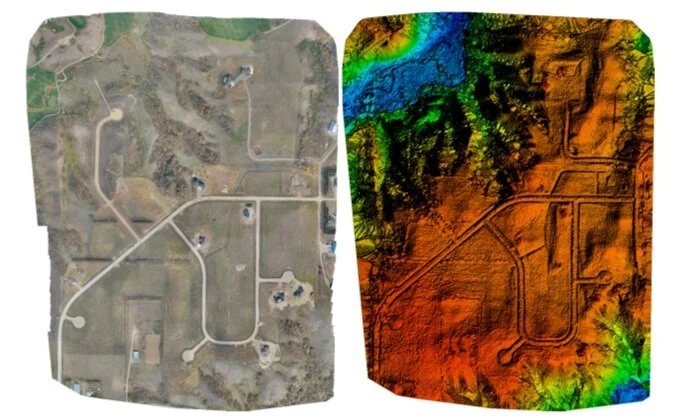
Aerial View Photography is able to generate high-resolution images of areas with low-quality, outdated or even no data are available.
2D Mapping | $300+
Covers up to 100 acres of mapping with each additional acre being $5
3D Mapping | $400+
Covers up to 100 acres with each additional acre being $10
3D Building | $450+
Covers one building or structure with each additional building being $150